search.ch

ViaFrancigena

Regional route No. 70, (Canterbury)–Ballaigues–Col du Gd St-Bernard–(Rom)
  • Image 1

Description

Regional route
No. 70 ((Canterbury)–Ballaigues–Col du Gd St-Bernard–(Rom))
Length
195 km
Ascent • Descent
↑ 5600 m • ↓ 4000 m
Lowest point • Highest point
372 m • 2484 m
Grade
easy (hiking trail)
Fitness level
difficult
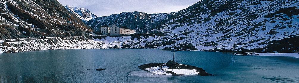
Established 2000 years ago, in medieval times the ViaFrancigena became the most important pilgrims’ path in Europe. In Switzerland it leads through beautiful Jura and Alpine landscapes, the stage on the Grossen St. Bernhard being particularly magnificent.

Height profile

Weather:

Comments about this activity or place?

Thank you for your feedback!